The software underlying PhoneGap is Apache Cordova. The software was previously called just "PhoneGap", then "Apache Callback". Apache Cordova is open source software. ... http://en.wikipedia.org/wiki/PhoneGapApache Cordova is a set of device APIs that allow a mobile app developer to access native device function such as the camera or accelerometer from JavaScript. Combined with a UI framework such as jQuery Mobile or Dojo Mobile or Sencha Touch, this allows a smartphone app to be developed with just HTML, CSS, and JavaScript.
Showing posts with label Android. Show all posts
Showing posts with label Android. Show all posts
May 15, 2014
PhoneGap - building native mobile applications using HTML, CSS and JavaScript
PhoneGap is an HTML5 application framework to develop native applications for mobile devices through integrations of web technologies, HTML5, CSS (CSS3), and JavaScript.


Jul 5, 2013
Offline Maps - RMaps and Mobile Altas Creator for abroad traveling
I don't why Google's offline map is so unfriendly. The maps of Japan can not be cached.
Fortunately, the old solution "RMaps and Mobile Altas Creator" is used again. Users can download the solution pack from: Mobile_Atlas_Creator_1.8_Settings_for_zh-TW.zip (including Official program, SQLite libraries and settings for "Big Planet SQLite" format).
Followings are heuristic steps for creating offline maps as one sqlite file that can be copy to Android's RMap App.
 |
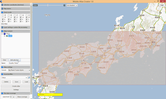
| 1. Create 0-6 levels world map. Thinking you will start for the earth and zoom into your cities, the step avoids missing your starting point due to without map data. |

 |
| 2. "Zoom in" to see the whole path that you'll transport from (e.g. Fukuoka) to (e.g. Tokyo) |

 |
| 3. Select the maximal transportation area so that you can see a coarse grain map while taking JR train for example. |

 |
| 4. Add more level (e.g. 0-12), it depends on the number of tiles.In this example, 8612 tiles are acceptable, no more than such number. |


 |
| 5. Type the submap's name and add selection. |

 |
| 6. Check the level of tiles is correct as your desired. |

 |
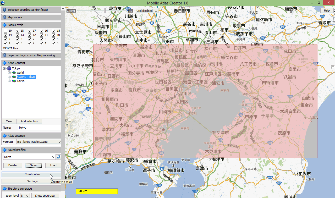
| 7. The same process is applied to select and add the map of your target city (e.g. Tokyo). Select the maximal city area that you'll visit and set 0-18 levels so that you can clearly see streets and building shapes on the RMap offiine map. |

 |
| 8. Save Profiles so that you can load this setting again for next city without adding "world" and "transportation" maps again. |
 |
| 9. Click "Create altas" then wait a long time for crawling map tiles. |

 |
| 10. Finally, you'll see .sqlitedb file in your FS folder "altases" in your MOBAC directory. |

Copying the completed .sqlitedb file to Android's storage (e.g. sdcard1/rmaps/altases), and use your RMaps app by selecting the .sqlitedb map file.
NOTE: Take practice on using RMaps, including:
- Switch maps from cityA (Fukuoka) to cityB (Tokyo).
- Input your Google Map locations by downloading as .kml files that can be imported into RMaps as categories.
- Check you places are covered by RMaps' offline map. If not, don't worry. You don't need a lone time for creating maps again. Just use the "Offline" function of RMaps to cache a small area, it works.
Subscribe to:
Posts
(
Atom
)